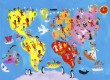
- Arthur H. Robinson of the University of Wisconsin created his projection in 1963 to show the entire world at once. The map was flat but roughly resembled the common depiction of the world. This desire led to a compromise between accuracy and aesthetics.
- Robinson made his map by trial-and-error with computer simulations. He created a table that listed how far above or below the equator the horizontal lines of latitude would be. The lines of longitude, which start in the center with the pole line running straight and then begin to curve away from the pole line, were positioned by estimation.
- Most cartographers, or people who chart maps, do things differently. They start with coordinates based on latitude and longitude, which are taken from a model of the Earth. They then develop geometric formulas that convert these coordinates onto a flat map, giving a high degree of accuracy. For example, the Peters Projection developed in 1974 by Dr. Arno Peters shows an area-accurate depiction of the world, but the use of a flat surface results in the countries appearing stretched from north to south.
- Although the areas of the continents on the Robinson map are accurate, the map does face several criticisms. The lines of longitude and latitude curve away from the pole line as you move to the extremes of the map, such that the visual space between them increases. The actual distance between these lines on the surface of the Earth is constant, but eliminating the curvature of the Earth results in curved lines of longitude on the map. In practice, this results in a slight stretching of the edge of the map, in the areas dominated by the Pacific Ocean. The map therefore lacks equidistance, in that there is no single point from which all distances are shown accurately. The map also lacks azimuthality, because standard compass points do not match the projection. In fact, the Robinson Projection has very limited scientific uses and was designed to be a visually appealing map of the world.
Origin
Creation
In Standard Cartography
Criticism
SHARE


